 Public Land Hunters …get the deer hunting strategies you need
Often times the best place to start your search for a new hunting spot, will mean using the web to find an interactive mapping application.
For us this means using the Wisconsin DNR’s mapping application, but search your particular state for something similar (most states have everything online today).
The amount of information you can gain in just a few hours of work online will save you many times that amount of hours compared to physically being in the woods burning up boot rubber and sweat. Obviously, there is no substitute for following up the spots you have identified online with in -the -field scouting, but it will save some time.
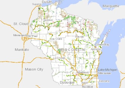
For us in WI or those traveling from out of state there is tons of public land to choose from!
The ability to find boundary lines, look at different types of terrain, and vegetation changes within some of these mapping applications…. really helps you find more deer and have a better hunt.
Within the Wisconsin’s DNR mapping application you can turn on and off various layers to help you initially see where some public land is close to home, and then adjust the transparency of that layer to see the type of vegetation present underneath.
To see how to do this watch this video here.
We can use this mapping application to actually see deer trails in swampy or more open areas. This tells me there are some deer in the area and how I might position my treestand in relation to some of these trails for any given wind.
Of course, the next step is to go out and check some of these spots you have identified to see if there is any fresh deer sign.
So much can change from one season to the next. Often these maps are updated every few years so what’s happening now might not be the same as it was last year.
New clear cuts and changes in crops can dramatically change deer travel patterns (as you know) so just because something looks good from an aerial map doesn’t necessarily mean it will be good once hunting season comes.
It’s nice to pick out a bunch of spots using the aerial mapping applications, but a good amount of time definitely needs to be dedicated to looking for fresh deer sign in the areas’s you plan to hunt.
Another resource that we also use in conjunction with the DNR mapping application is Google Earth and Bing Maps. Both have different types of imagery and sometimes Bing Maps has more detailed viewing in certain areas, but not always.
If you currently don’t have access to Google Earth here is the link: http://www.google.com/earth/download/ge/agree.html
With Bing Maps you can pick out different types of trees within the areas you will be hunting.
To access bing maps click here. Once you get there click the bird’s eye view where I have the red arrow pointing, and zoom into the area’s you would like to hunt.
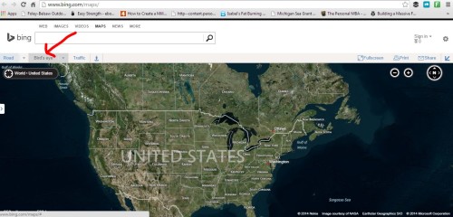
Select the Bird’s Eye view where the red arrow is pointing to see aerial wizardry.
Why is this important…you might ask. Well, I know that oak trees will often hold their leaves longer than most other deciduous trees come winter.
As you know, deer love acorns, so keying in on areas that have oaks can help me find feeding areas and set up my stands accordingly.
Looking at this picture will give you an example of what I am talking about. You can see the oak trees where I have the red arrows pointing (you can see how easy it is to pick them out). Of course, not every tree will hold its’ leaves so just because you don’t see any brown leaves on the map doesn’t mean there aren’t any oak trees present.
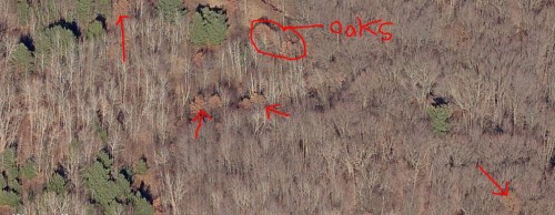
See the oaks? I have the red arrows pointing at them.
You can easily identify all of the coniferous trees as well (pines, balsams and cedars). This is nice too, because deer will often use these types of trees for bedding cover, particularly in winter.
I hope you are begging to see why we start with an aerial mapping application when we are deciding where to hunt.
It is my hope for you that you find success in the woods this fall.
Using these tools is a step in that direction. Technology can be frustrating at times, but this stuff is nice.
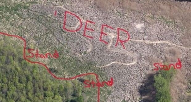
Another key feature to look for that can at times be crucial to finding deer travel patterns is…
…points or other land masses that jut out into clear cuts, swamps or marshes. These areas will often be loaded with deer sign and you can jump from point to point, allowing you many different hunts in the same area.
Here is an example on the map below:
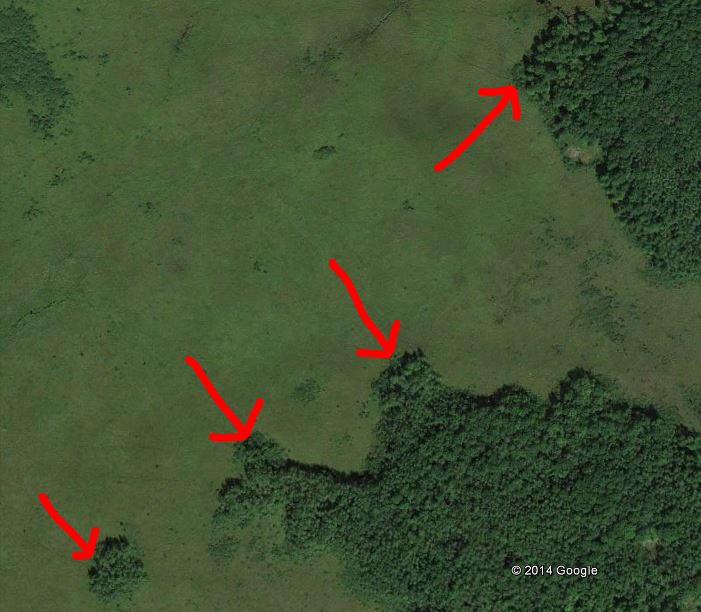
Make sure to check out points like these, jutting out into swamps, marshes, or clearcuts.
Finding new areas to hunt this fall doesn’t have to be hard. Just make sure to check out all of the different types of mapping applications available and you might just find the best deer hunting…ever.
If you enjoyed this post make sure to subscribe here for more informative articles, hunting video’s, and recipes.
Subscribe Here!
Happy Hunting,
Nick Gaede